Southernmost backpacking trail in the world: Dientes de Navarino, Patagonia, Chile
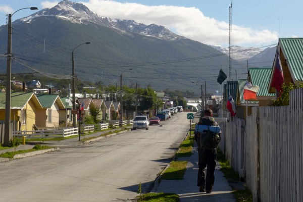
 People call Tierra del Fuego “the ends of the earth” – but Navarino Island is even farther south, on the other side of the Beagle Channel from Ushuaia. It hosts the southernmost permanent human settlement in the world (other than Antarctic research bases), Puerto Williams, and is the last bit of land before Cape Horn.
I’ve actually been to Navarino numerous times – including to work with the indigenous Yagán descendants there, translating the book of traditional Yagán tales Hai kur mamashu chis from Spanish to English. I have long wanted to go back, though, to hike the infamous Dientes de Navarino: the southernmost backpacking trail in the world.
The trip was adventurous, to say the least… at times, actually scary. I was hiking solo, and parts of the route are not well marked: so it’s important to stay mentally present (not getting off track at all) as well as physically safe (not falling and getting injured) – or you might never be coming back down. And, although I chose to go in February, which is the peak of summer (equivalent to August back home), snow storms can hit here at any time. Which is what happened to me… so I could not go where I wanted to go, it was just too dangerous – I had to take an alternative route out.
Anyway, here are a few highlight pix, from what was a very challenging, and at times scary, trip. It’s one of my few trips where I felt there really was a risk that things could have gone terribly wrong – but thanks to good gear and good decisions and a high level of fitness, I made it back out!
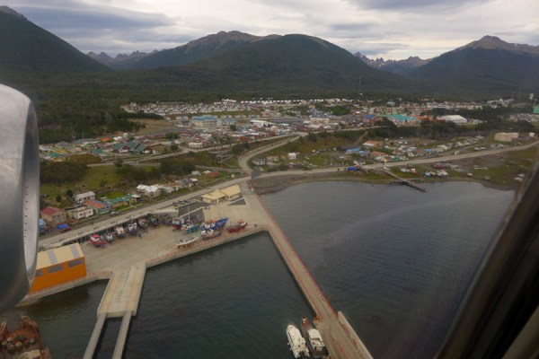
Flying in to Puerto Williams from Punta Arenas.

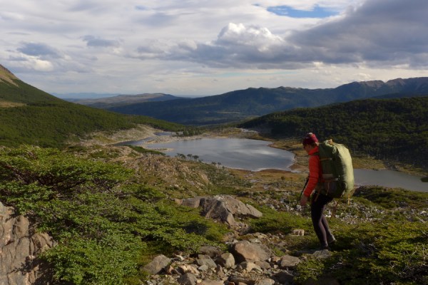
Ascending above the treeline (which is only 500 m), Beagle Channel and Tierra del Fuego in the background.

Now above the trees and most vegetation – not much of a trail.

Little pockets of warmth if you can find shelter from the wind.

“Dientes de Navarino” are the “teeth” of Navarino: sharp and jagged.
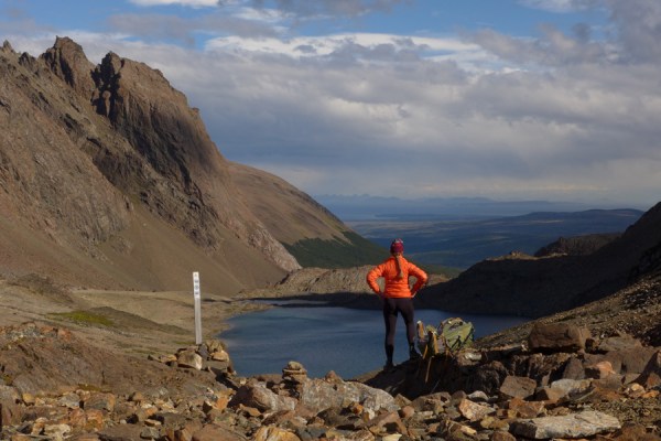
Finally – crossing the big pass, with views to Bahia Windhond and, beyond, Cape Horn.
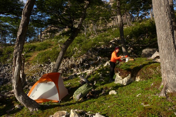
First camp for the night – really excited to have my new ultra-lightweight Big Agnes Copper Spur one-person tent for this trip. You need good tents here because of the crazy winds – but at the same time, you need to travel light. This tent turned out to be great for both.

Made it to Bahia Windhond, where there was a cabin and a few backpackers, for the night. The forecast was for snow, so I was a bit worried about whether I would be able to get out (back over the high country) the next day.

I hooked up with a group of Europeans the next day (it just was not safe to travel alone in that weather). We made it most of the way up to the pass, but I just did not feel it was safe to keep going up higher in these conditions – so we amicably agreed to separate. I went back to Windhond – worrying about them all night. I later found out that they holed up right near where I had left them, and had a horrible cold and wet night. (Meanwhile, I was back down at sea level – still cold and wet, but at least eating a hot meal: fresh meat caught by the local beaver trapper. Beavers are introduced pests there!)

Even getting out the next day was really hard. Two Czech guys agreed to let me accompany them out an alternative route (that wasn’t on my planned itinerary, so I didn’t have a map or information for). The going was so rough – through icy bogs flooded due to beaver activity, and windfallen Patagonian forest. We covered a two-day route in a day. My ultrarunning experience sure served me well here… I can’t explain how hard it was (hence almost no pix).

Just one example of the forest we were going through. And the Czech guys’ legs were about a foot longer than mine… really hard for me to keep up with them, with my big pack on, through this stuff.
But we survived it… here we are arriving back into Puerto Williams. One of those expedition experiences that is not so much fun while you are doing it… but you are so glad you did it after!
