Karsting away in Raja Ampat, Indonesia
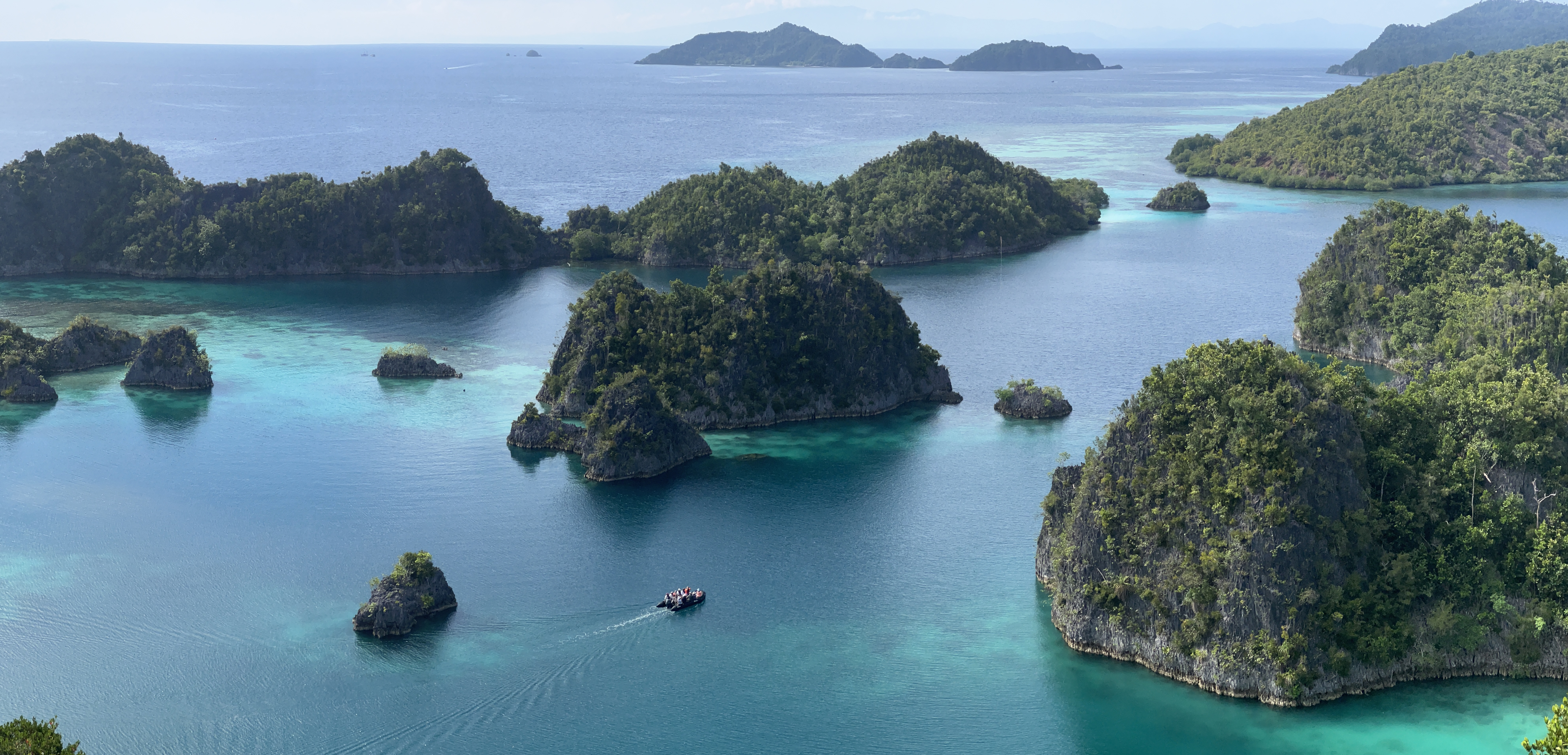
Zodiac cruising through the karst landscape of the Piaynemu Islands, West Waigeo, in Raja Ampat, Indonesia.
I started to write this blog post last April, while happily cruising through Island Southeast Asia, on board SH Minerva. My whole voyage contract was for two months: starting in Solomon Islands at the beginning of April, then continuing through Papua New Guinea, Indonesia, and Philippines, then finishing in northern Japan at the end of May.

But life is super busy when you work on an expedition cruise ship, and I never finished the post. So here we go, a vignette from an amazing day in the famously beautiful islands of Raja Ampat, Indonesia, just off the northwest coast of the island of New Guinea.
It is a super interesting place for a geologist! These distinctive landforms are part of what we call a karst landscape. Karst is simply limestone that has been uplifted and weathered by rainwater.
Most limestone is created through biological processes in the shallow ocean, and is composed of the hard calcite parts deposited by organisms such as coral and molluscs. Those hard calcite parts might be microscopic (making very fine-grained grey limestone), or they may be in big chunks, so you can see fossils of those corals and shells in the rock.
(Here I am on the zodiac explaining that to my guests – thanks to my colleague and roommate Qi for this pic!)

Limestone’s main mineral, calcite, is soluble in rainwater (in fact, rainwater combines with CO2 in the atmosphere, forming very weak acid). Not all limestone is formed from broken shells – but the limestone that is may be very porous. Therefore, when limestone gets uplifted (for example by tectonic processes), it is susceptible to erosion by that slightly acidic rainwater, which not only runs over it but also through it. (That’s why most cave systems are in limestone!)

So that’s a brief explanation of how this unusual, scenic landscape of Raja Ampat – these evenly scattered island mounds, nestled in a turquoise coralline sea – formed. This is classic karst landscape!
In the case of Raja Ampat, these limestone deposits are of varying age – some is very young (Miocene) and some is well over 300 million years old. (That is way before mammals existed – way before even dinosaurs existed!)
The photos I am showing here are all from the Piaynemu Islands, off the western part of Waigeo Island, one of Raja Ampat’s four main islands. The distinctive karst landscape here, characterized by these even-sized mound-shaped islands, is a result of another geological complication: there are two fracture sets running through the rocks. These two fracture sets are perpendicular to one another, so they form a shape like a tic-tac-toe board. Rainwater running through the fractures gradually dissolved them, over the years making them wider and wider, and eventually leaving the centres as these evenly sized and evenly shaped islands.
Super cool! An example of how underlying geology influences our landscape! Here’s a fun little video of me driving the zodiac at Piaynemu Island, and explaining that geology to my guests – thanks to my roommate and colleague Qi (I had no idea she was filming this!)
Later on our voyage we passed through the Philippines. One of our stops was on Bohol Island, where we visited the famous Chocolate Hills. You can see here how similar the karst geology is – all of these evenly spaced mounds (there are over a thousand of them!) But, in this case, sea level is much lower relative to the land level – so rather than being individual islands like they are at Piaynemu, these karst mounds form individual hills.

I work super hard as a guide and lecturer on expedition cruise ships (there is a lot more mundane work to do than most of you would ever see!) But I sure do appreciate the opportunity to see and know these very interesting places – as well as all of the first-hand learning I get to do in my fields of interest (geology/anthropology/history, especially through the South Pacific and Patagonia). If you would like to know more about what I am up to, you can explore this website more (especially the What’s happening! page, or go to Fun! to see my exact itineraries) or you can simply Contact me here.
My new article(s) about Polyesian canoes!
Yay – it is always exciting when you get a newly printed book which you are a contributor to in hand!
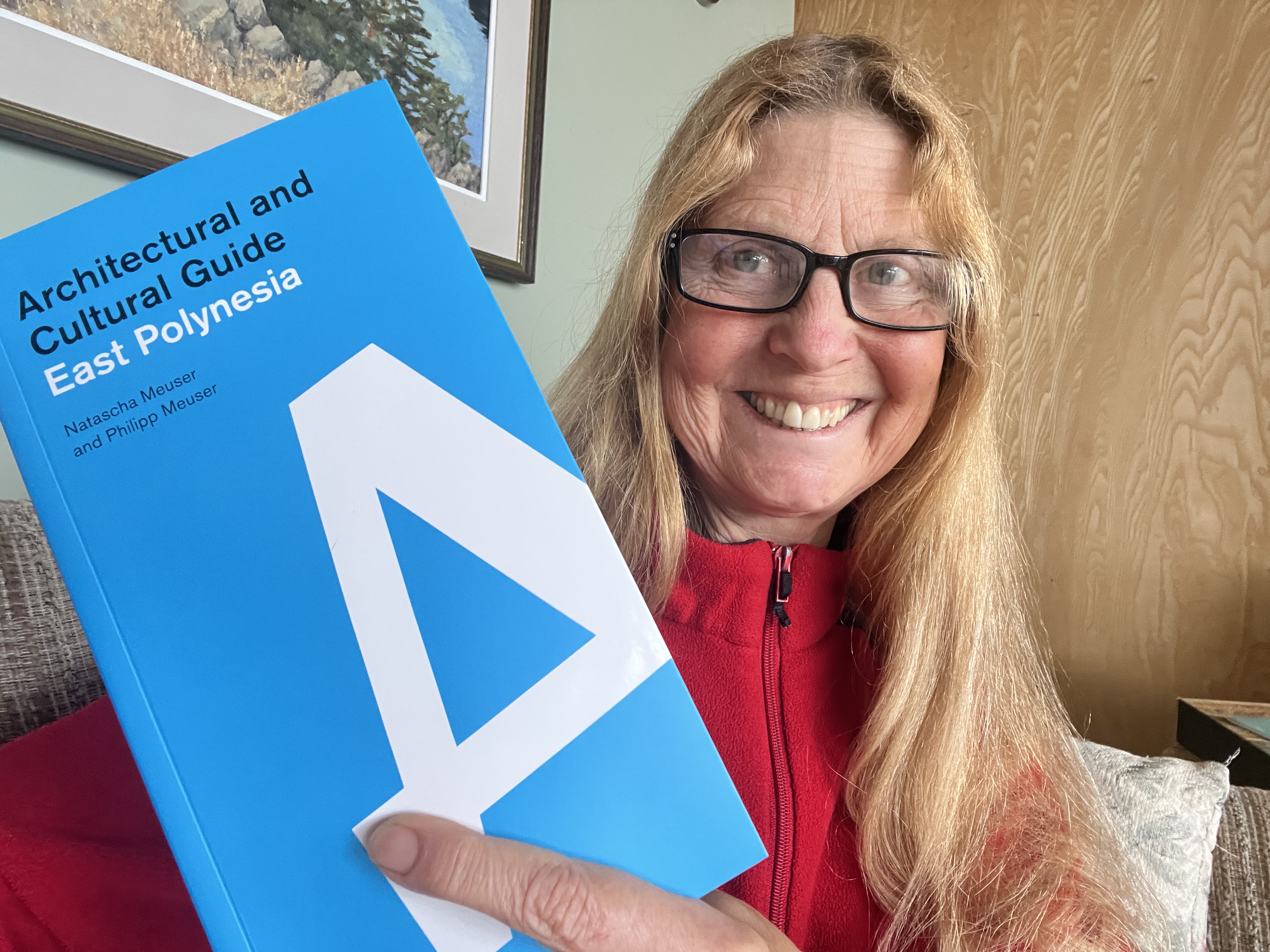
I was invited to write articles for two books about Polynesian canoes and culture by the publishers, Philipp and Natascha Meuser (DOM Publishing in Germany). I have just received my copies of the East Polynesia book, and the volume about West Polynesia is currently in press!
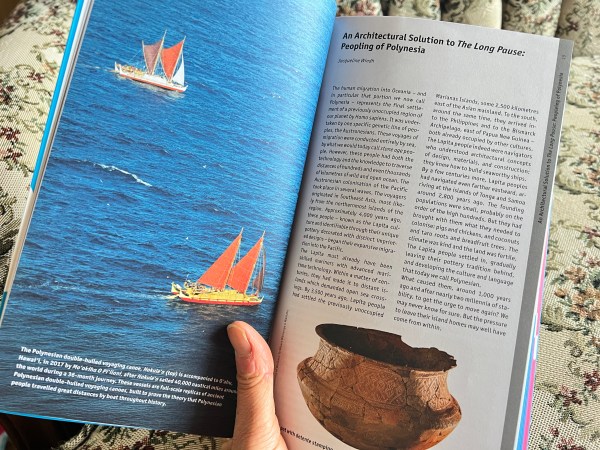
My contribution to this first book is a chapter on how Polynesian canoe design allowed these incredible maritime architects and navigators to settle most of the Pacific Ocean in just a few centuries.
The second article, for the West Polynesia book, goes into a lot more detail about canoe and sailing craft construction.
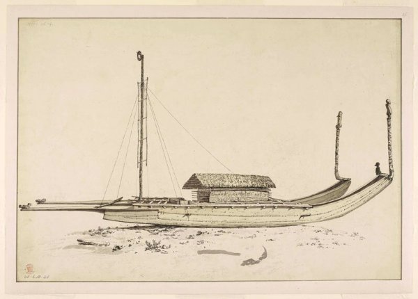
(The second article also addresses why we call these great sailing ships “canoes.” Basically the answer comes down to: if they were built by Europeans they are “ships,” and if they were built by brown people then they are “canoes.” Well, the Polynesian canoes were not only as big as the first European ships to encounter them – they were faster and more manoeverable! Captain Cook wrote, of the vessels he encountered in Tonga, “Amongst these canoes, there were some double ones, with a large fail, that carried between forty and fifty men each. These sailed round us, apparently, with the same ease, as if we had been at anchor.”)
Here is a drawing by John Webber, official artist on Cook’s third voyage (1776-1780), showing a typical double-hulled sailing canoe.
These could be 15 m long (or more) and carry hundreds of people.
The double-canoe design (both double-hull and outrigger) originates with the Austronesians, ancestors of the Polynesians. The Austronesians migrated out of their Taiwan homeland around 5000 years ago, eventually settling a vast area of the planet (nearly half its circumference!) by sea: from Easter Island/Rapa Nui and Hawai’i in the east, to Madagascar in the west.
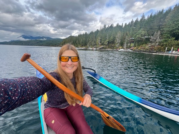
And today, their double-canoe design has made it around the world – from catamarans used as ferries and work boats, to high-tech racing catamarans, to outrigger canoes like the one I am paddling here. (This is me last week, sneaking in one last paddle as our weather here on Vancouver Island transitions from summer to winter – we don’t really get autumn here).
Anyway, I am super pleased with the design and layout the editors have come up with – lots of room for sketches and photos. I look forward to receiving the West Polynesia book in hand in a couple more months!
And – bonus to me – the research for these articles forms a part of the base for my next book, which will be about these very earliest ocean sailors and navigators.

I am excited to be heading back to Polynesia in November – as guest lecturer on the small cruise ship Paul Gauguin! If you would like to know more about this voyage (or about any other upcoming opportunities to travel with me – or about how to get a copy of this Architectural and Cultural Guide to East Polynesia) please go to my Contact page and sign up for my mailing list. (Don’t worry, I don’t send many newsletters out at all – and I absolutely will never spam you or share your contact info!).
Our first year in our lakefront Sproat Lake home!

Well it was never Dave’s and my intention to operate a vacation rental home on Sproat Lake… but sometimes things do not go according to your Plan A. We had hoped to share the property, but we’ve ended up buying both of his sisters out of the family lakefront cabin. The bad is that we now have a big mortgage… but the good is that it is our place now, and we expect to use it and love it for the next 30 years! (Dave’s parents both continued staying out here until they were 90ish, and we totally plan on doing the same). It is an amazing place – I think the best views of anywhere on Sproat Lake – and with canoeing, kayaking and an amazing set of hiking and biking trails all at our doorstep (all our favourite activities, check out the photos at the bottom of the post) – and it is only a 15 minute drive from our home in Port Alberni!

So this was our first full summer (well our first full year!) being 100% owners. We don’t WANT to run a vacation rental business – that was never our intention – but we plan to do a couple short-term rentals the next few summers, just to help with the costs. So, while enjoying our first full summer here, we’ve been working on some improvements too!
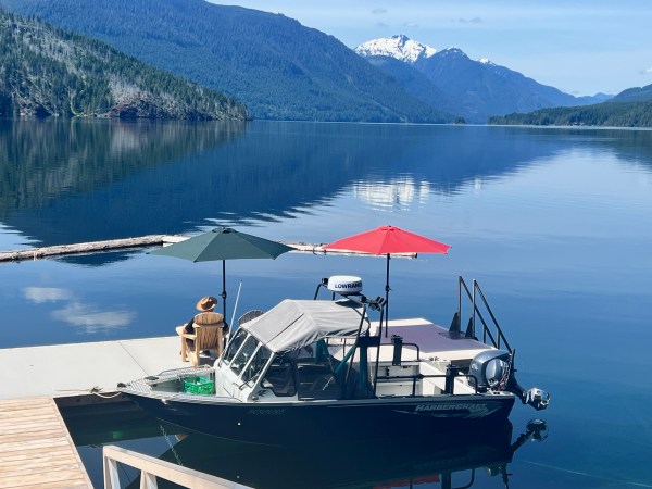
It’s amazing, after a few decades of neglect, it is like a completely different place now. We had a big decision to make about the old dock – keep throwing money into it or just get a new one. So we are loving our new big and solid concrete dock! A sheltered spot for the boat… and so peaceful for morning coffees or a glass of wine at sunset…


The place is actually two cabins, connected by a huge deck, shaded by big Douglas fir trees, and a “breezeway.”
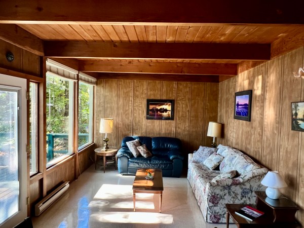
This is the smaller cabin – best views in the world! We’ve decluttered it and rearranged – it is now our sitting/dining area, and it also has one bedroom and a bathroom.
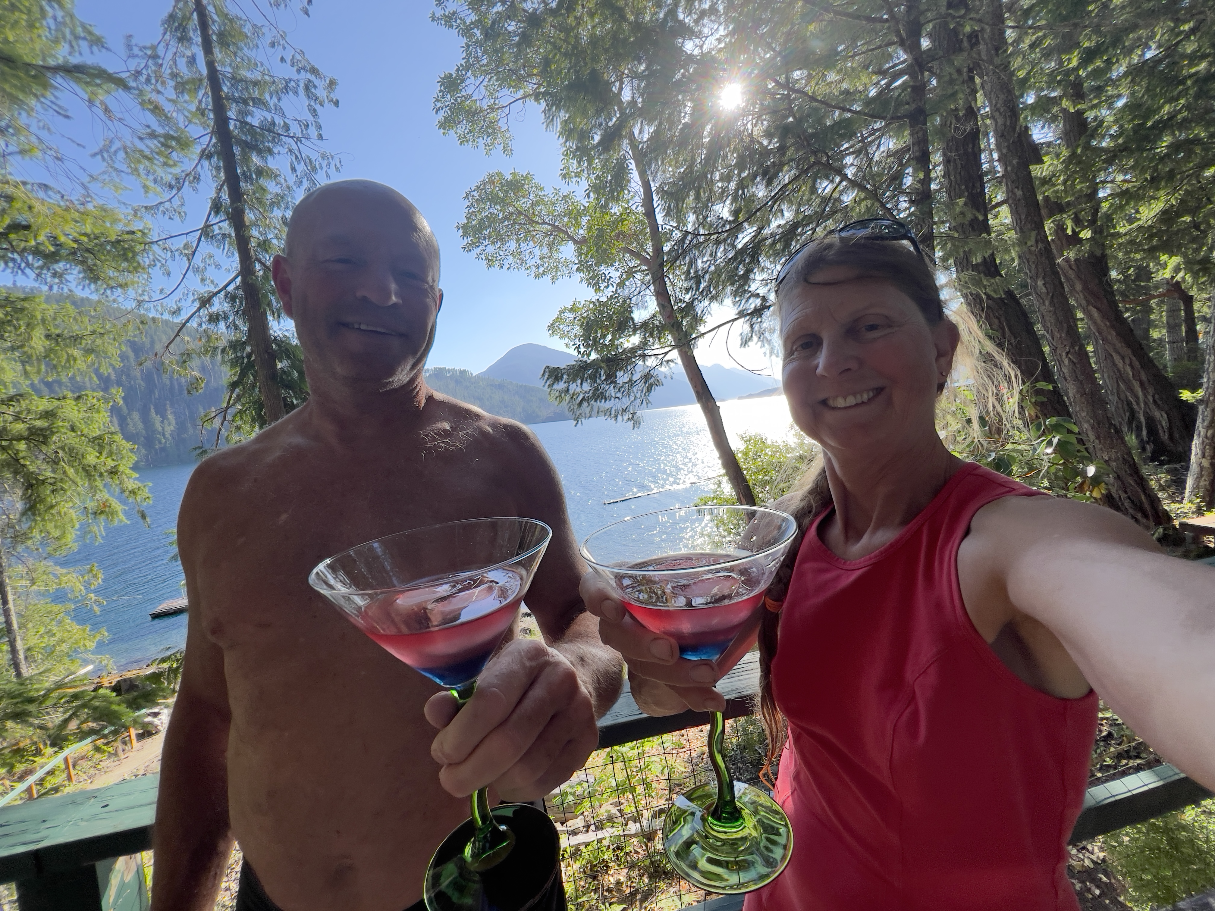
And then the larger cabin has the main bedroom, but we’ve reno’d to create another room that can be transformed into a second private bedroom, so we have room for friends now, too. We are so happy with the changes we’ve made – so nice and uncluttered now. We were going to remove that bar, below – it was loaded with old seashells and decades of cobwebs that looked like from the Addams Family – but now that we have it cleaned up, we love it and use it for making martinis!

Dave is always saying that his parents would be really happy if they could see what we are doing here, how much we love and take care of the place that they had the foresight to buy, and that has been in the family for fifty years.
We still have some more work to do – but we are getting there. And we sure appreciate the gift – receiving one third of this amazing Sproat Lake home from them. It was never our plan to own the whole thing, and it sure means some financial juggling for us. We are still figuring out all of the licensing and everything we need to do to hopefully be able to vacation-rental it out a bit the next few years, just to make it all work. Some challenges – but overall we are super grateful and feel so very fortunate.


I have lots of travels coming up! If you would like to keep posted on the exciting things I am doing, or want to hear about upcoming opportunities to travel with me, you can reach me on my Contact page.
Port Alberni’s new Quay to Quay Trail – our living history!
I sure haven’t been posting here much! I’ve been away a lot: working on a ship the last three months, and wasn’t in town much last summer either.
So I finally got out this week to check out Port Alberni’s new Quay to Quay Trail. And – wow – although there is still lots of work to do (mainly remediating and improving the shorefront lands that the City has expropriated for public use), it sure gave me a good vision of the municipal government’s foresight in making this happen.

But there was also a lot of hindsight, too…
What I mean by that is that this route really gives a glimpse of our town’s history, on live display too!
First, the old steam train was running. Ferg was not too impressed, but I was! The train used to run up to the McLean Mill, but now it just does a short run in town. But it is an important part of Port Alberni’s history (and one of only a very few operating steam trains in the world!)

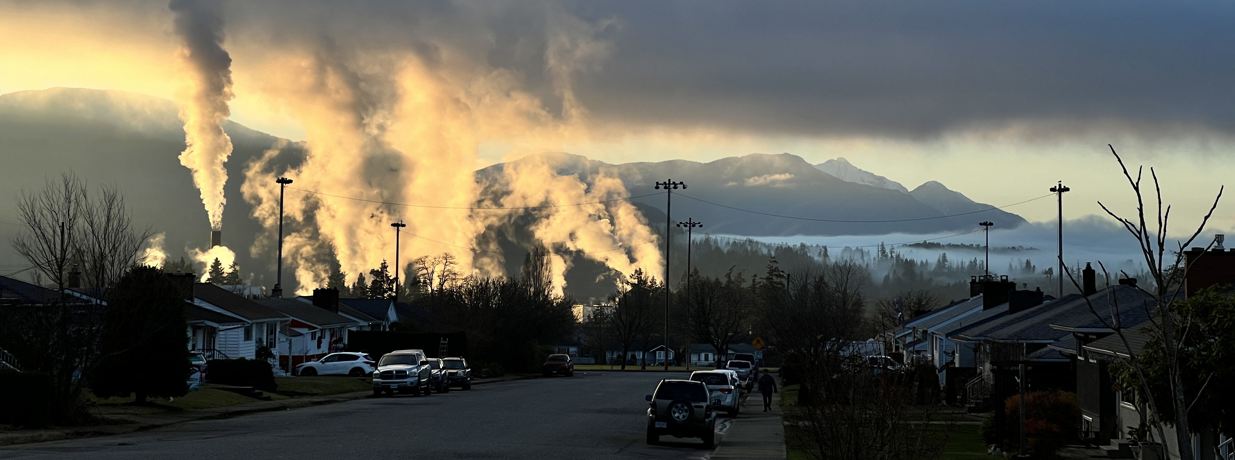
We had a beautiful day for our walk! The new trail roughly follows the waterfront, and alongside the pulp mill. Yes, logging is still important to Port Alberni.
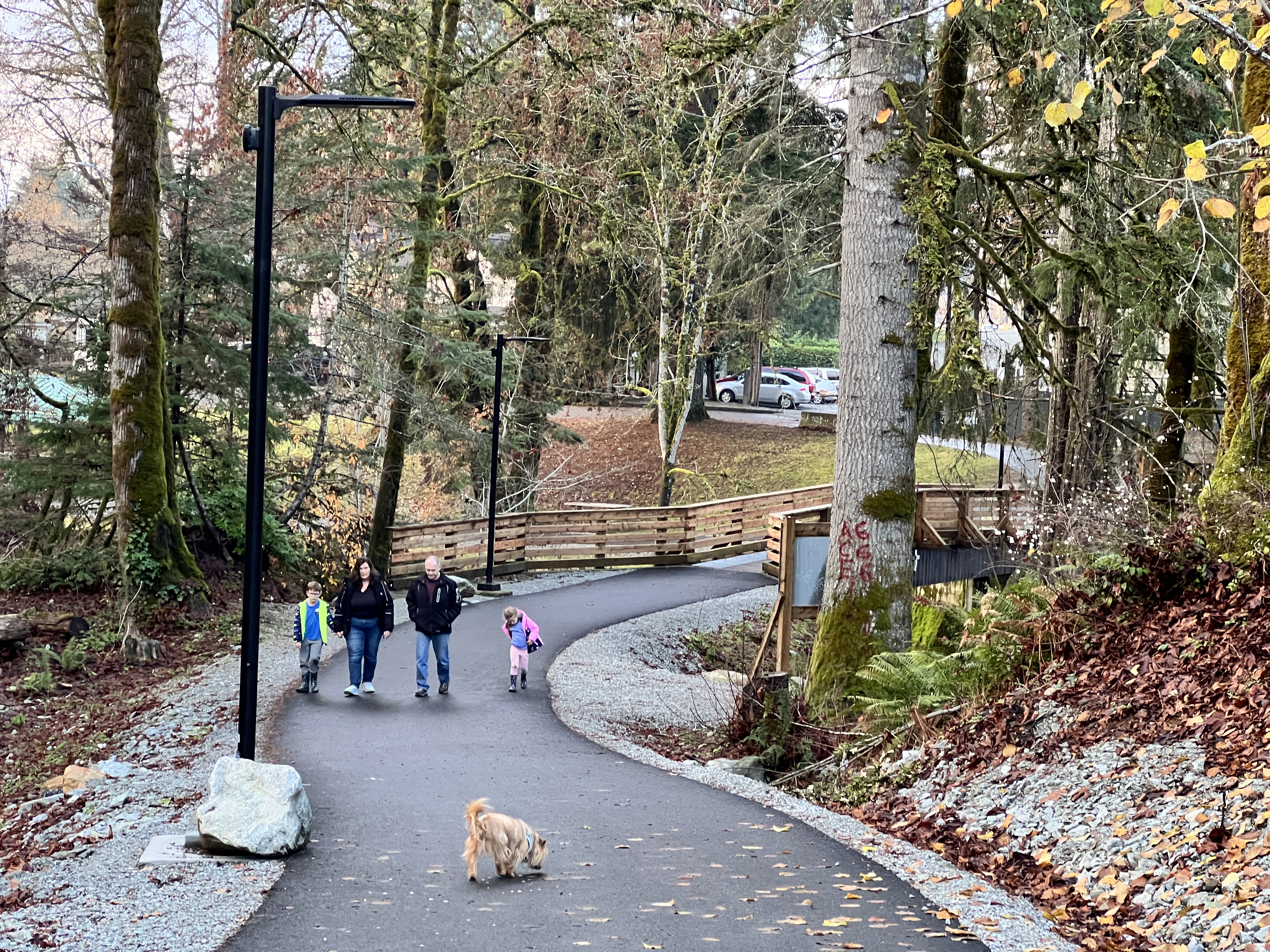
It continues on to Roger’s Creek, and from here you can hook up to a whole network of trails around the creek, or continue along the waterfront to Kitsuksis dyke. Dave and I walk Kitsuksis a lot in winter – especially if it is a sunny day (rather than being under the forest cover). We are both super happy about this new trail system!

And then I went out the next day, and guess what! The Philippine Mars Water Bomber was flying around! The other bomber left our lake this summer, for a museum in Victoria. This one is the last remaining flying Mars, and it is flying in a few days to its new home (on the ground), destined for a museum in Arizona.
It was such a big event for us out on Sproat Lake this summer, seeing the Hawaii Mars out on the water and sometimes flying, as they prepared her for her final journey. With all my travels away from Port Alberni, I didn’t think I would get to see the Philippine Mars at all. She is due to depart for good tomorrow. So it was an unexpected treat to see her, and have her go right over us, as Ferg and I were exploring the Quay to Quay Trail. Here is a little video glimpse, nothing fancy, just filmed on my phone – but special to me because I got to witness her very final days in the air:
A Trans-Pacific Polynesian Cultural Experience
I don’t really know how to give an apt title to this blog post. The experience I want to write about is as big as Polynesia – which I think must be the largest area on the planet that is inhabited by a single coherent cultural group.

Check it out: the Polynesian Triangle encompasses the region from Aotearoa/New Zealand, to the islands of Hawai’i, to Rapa Nui/Easter Island. Each side of the triangle is around 7000 km long!
Although most of its area is wide open Pacific Ocean, there are over a thousand islands scattered throughout the triangle. These isles were settled by canoe, by the ancestors of the Polynesian inhabitants, over a period spanning several thousand years.
I was fortunate enough to spend two months at sea as a lecturer and expedition guide with Silversea this March and April, traversing nearly the entire Pacific: from Valparaiso, Chile, all of the way to Fiji. I have always felt an affinity to Polynesia and to its strong and capable seafaring people. (I come from seafarer stock, too – I am 100% Viking genetically! My mother is from Denmark, and my dad was Swedish/Norwegian.)
I have visited some of the Polynesian islands in my own travels over the past several decades. A highlight was meeting many of the master canoe carvers from Aotearoa, Tonga, Tahiti, Cook Islands and Hawai’i when I was the photographer at the Lahaina Festival of Canoes in 2003 and 2004.
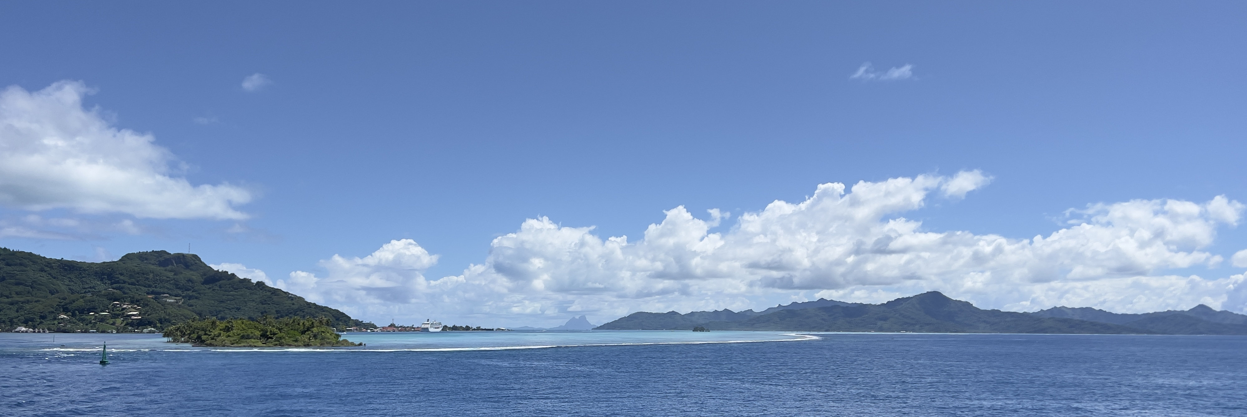
This voyage was very special, because we stopped at nearly all of the inhabited Polynesian island chains across the Pacific, including: Rapa Nui/Easter Island, the Pitcairns, Mangareva, three islands of the Marquesas, two atolls in the Tuamotus, Tahiti, Bora Bora, three of the Cook Islands, Niue, Tonga and Fiji.
These places are really hard to get to!

One of the many things that struck me on this voyage was how connected all of these communities are by language and culture – in spite of the great distances between them, and the fact that prior to the arrival of Europeans, some communities were not in communication with one another for centuries at a time.

One example of this is the horn that is blown when visitors arrive. Depending upon which Polynesian dialect, it might be known as a pu.
Traditionally, the pu was blown by a watchman to warn the community of approaching canoes, but on our voyage it was also used to welcome us visitors. Here is a fellow welcoming us to Aitutaki, Cook Islands, with a pu made of a conch shell.
My understanding of the word is that “ta pu” or “ka pu” means “the conch shell” or “the horn” (depending upon which Polynesian dialect, ta or ka means “the”). However, as for many indigenous languages, there are deep layers of meaning to Polynesian words that we just don’t have in our Indo-European based languages. So tapu or kapu also means “sacred” – and it is where our English word “taboo” comes from.
When we visited the island of Raiatea, west of Tahiti, a local guide named Tihoti carried a pu with him. He used his pu almost like a speech element: to round us up and gather us around as he explained the sacred site of Taputapuatea to us – the tone of his notes getting more sharp and urgent when guests wandered too far away!
Tihoti’s pu was made of a piece of rosewood for the mouthpiece, and the “horn” part was a shell that is not from here, but from New Zealand – the pu was a gift to him from Maori visitors.

One of the most moving welcomes we received was at the remote village Hapatoni, on Tahuata, part of the Marquesas chain of islands. This was not a place well travelled by cruise ships, and as guides we were not sure what to expect when we got to shore. We drove the first zodiac in, rounding the rock breakwater for our first view of the village, and were astonished to see so many villagers out, chanting and singing to welcome us, and a watchman striding out over the rocks to greeting us with a pu.
As one of the guides, I was one of the first on shore, so I shot some videos on my phone of this stunning scene as we brought the guests in. I had no plan in mind – but I realized when I got back to the ship that I had enough clips to edit together a little piece about our welcome there. It was so emotional, to be greeted like this – I hope my little movie rouses a bit of those same feelings in you!
I have lots more travels coming up! If you would like to keep posted on the exciting things I am doing, or want to hear about upcoming opportunities to travel with me, please go to my Contact page and sign up for my mailing list. (Don’t worry, I don’t send many newsletters out at all – and I absolutely will never spam you or share your contact info!).
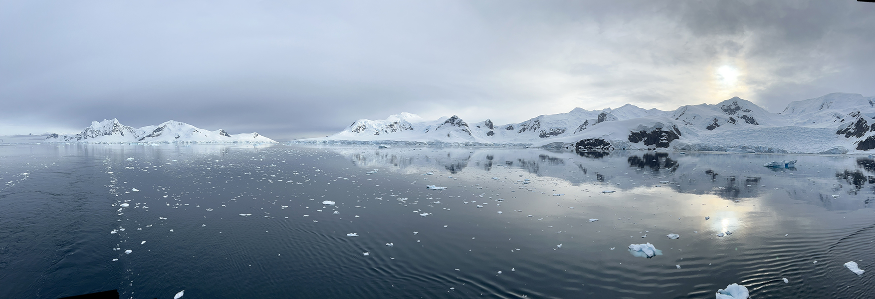
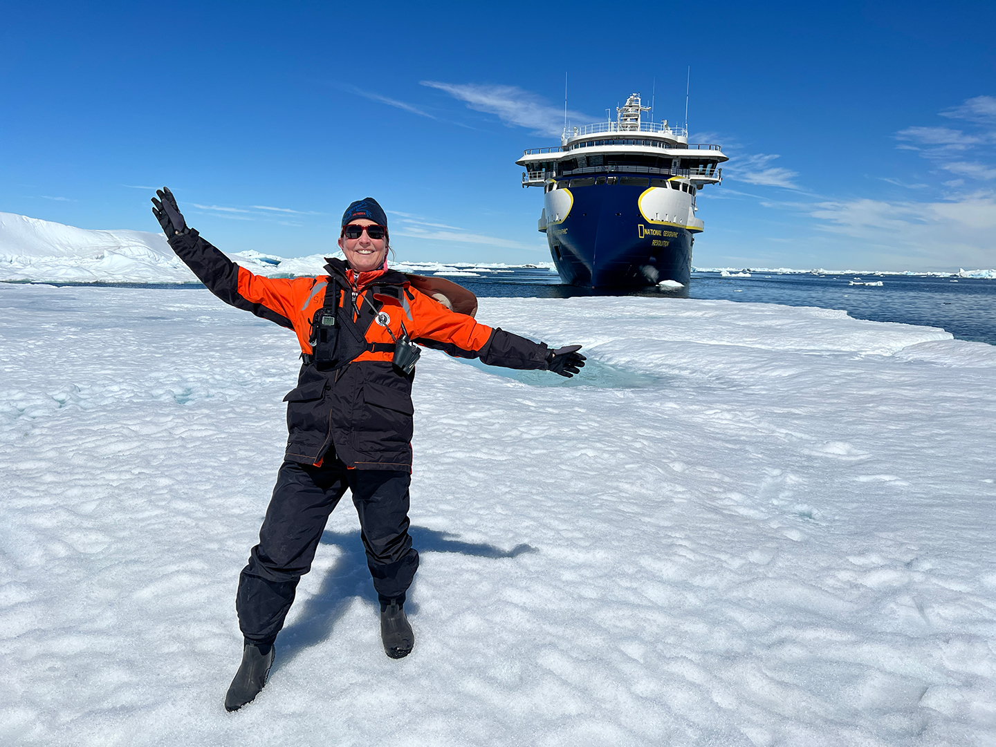
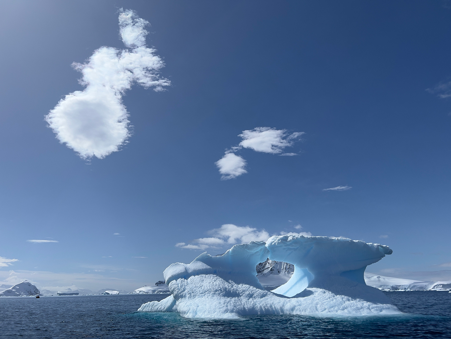
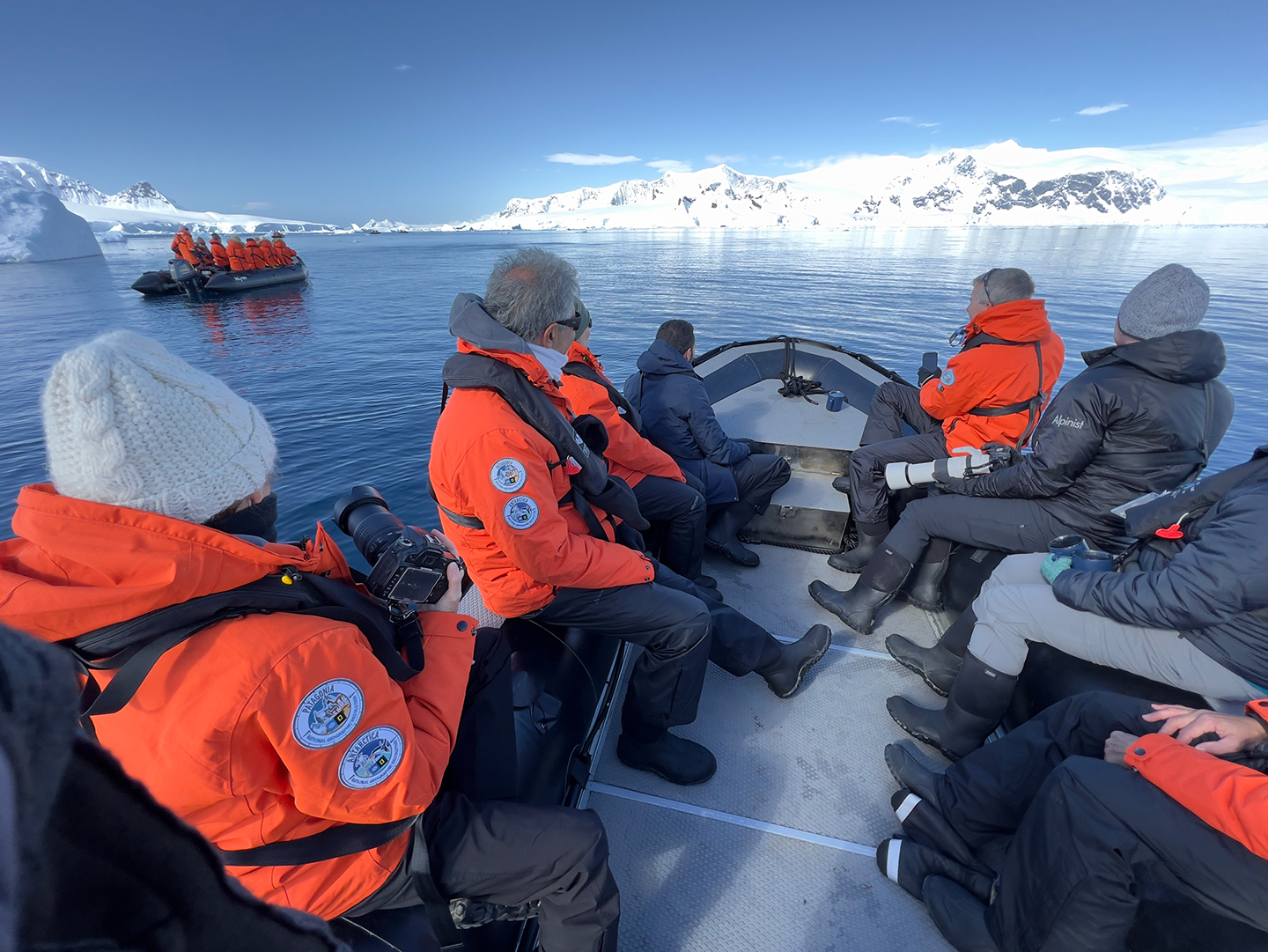
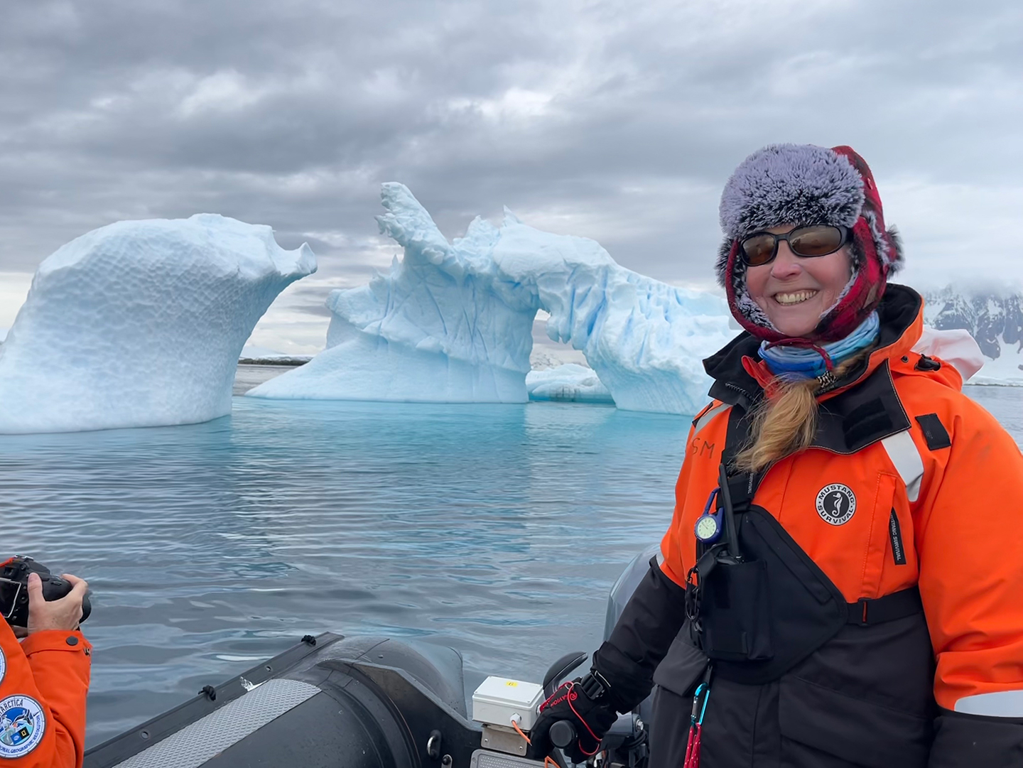
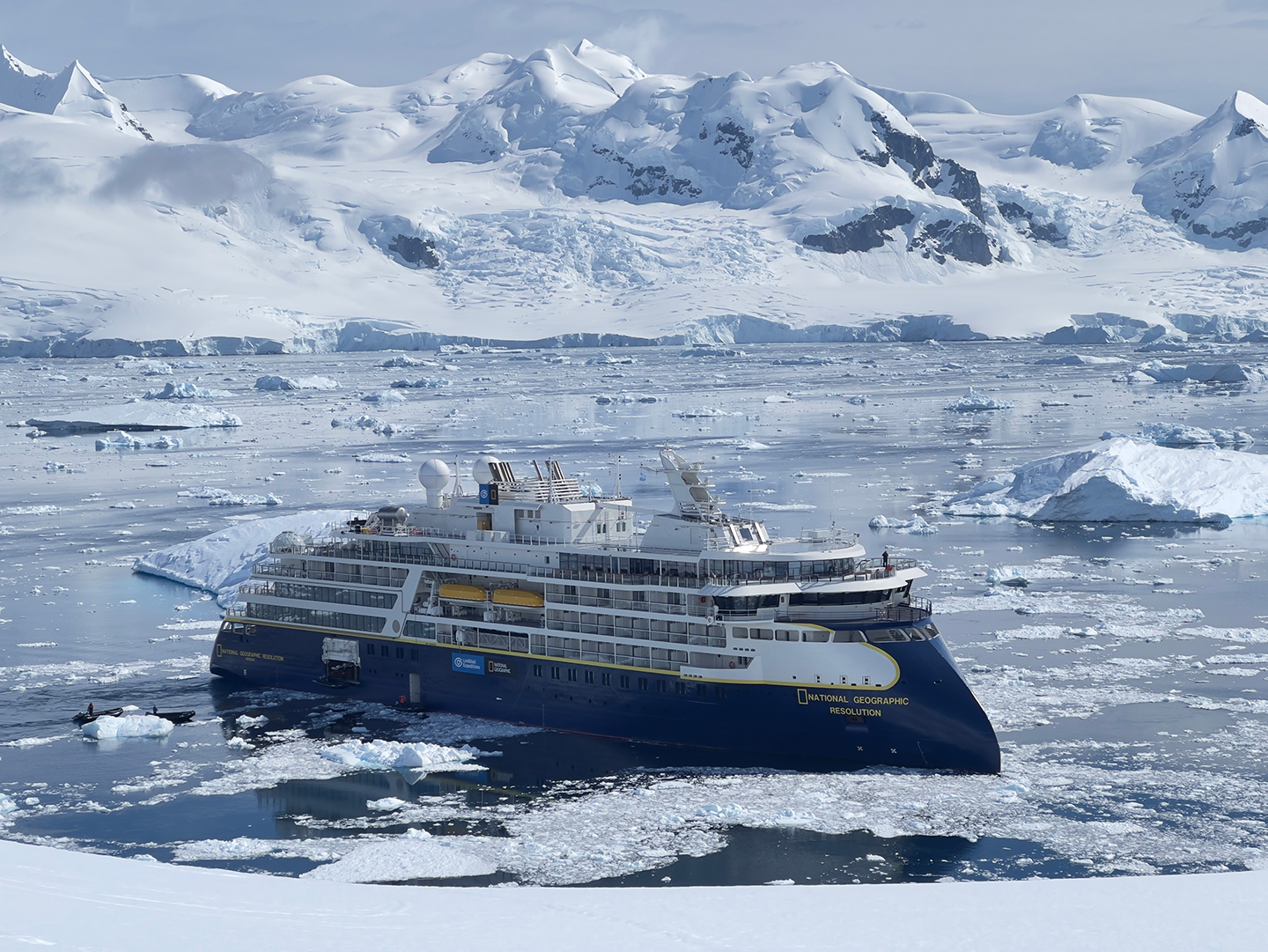
The Ice: Christmas in Antarctica
Back when I was working as a geologist in Australia (um, well over two decades ago) I had a colleague who was working in Antarctica – which he always referred to as “The Ice.”
Well, now I am getting to know this spectacular wilderness too, and building up my time on or near The Ice. I have just finished a month working for Lindblad Expeditions, as an expedition guide and naturalist/lecturer: our route had us first in Patagonia, and then down in Antarctica.
Here are a few pix from our last week at The Ice, all from Christmas week, uploaded as I travel home (currently in Santiago de Chile). Hopefully I will find the time to put up a few more posts (and videos) once I get home!
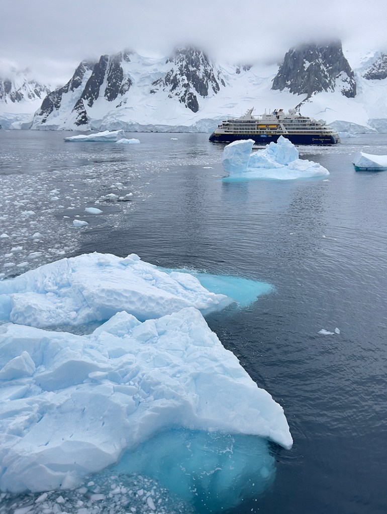
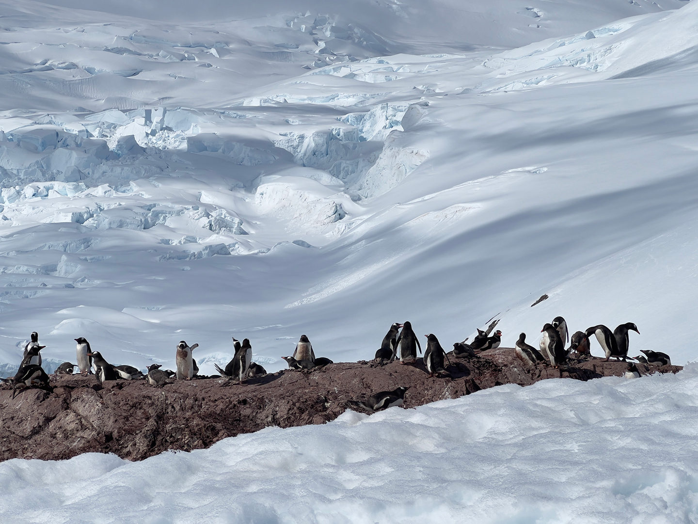
A highlight of our Antarctic voyage was, as our Captain Martin Graser explained to us, making history – by traversing narrow and spectacular LeMaire Channel alongside our sister ship, the National Geographic Endurance.
Leaving Puerto Williams, Navarino Island, Chile

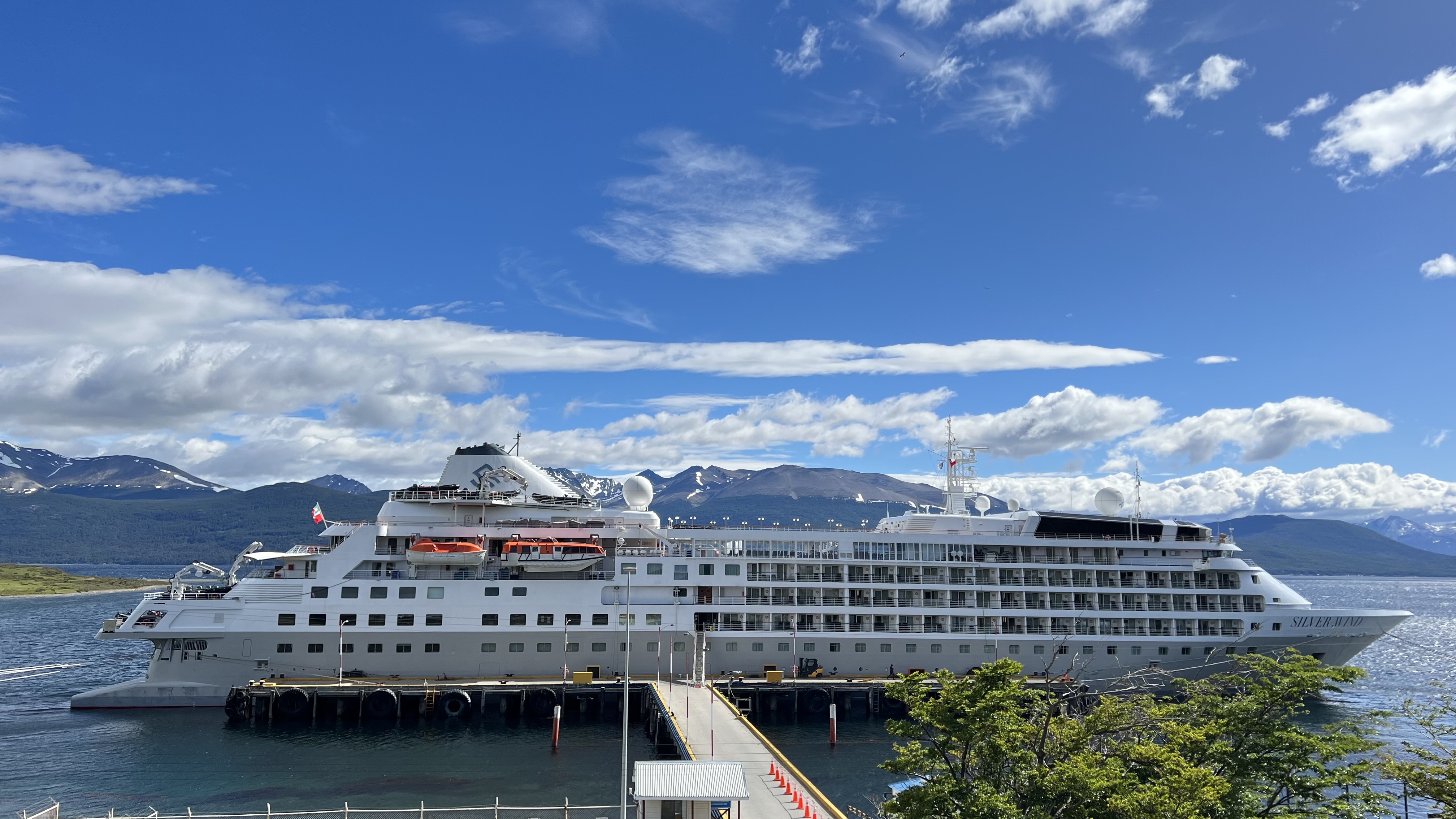
I am just in from an amazing voyage – sailing all the way from Vancouver, Canada, down the Pacific Coast all the way to Puerto Williams, Navarino Island, Chile. I have been working for the expedition cruise company Silversea on the beautiful vessel Silver Wind.
Puerto Williams holds such a special place in my heart. Right from my first visit here in 2004, I felt at home. As a very remote island community of only a few thousand people, it reminded me so much of Tofino, Vancouver Island, where I was living at the time (and I still live near Tofino, now in Port Alberni). I came to know the Yagán community here, and worked with author Cristina Zárraga to translate the stories of her Yagán grandmothers to English (that book is called Hai kur mamashu chis, and yes it is still in print and available on Amazon).
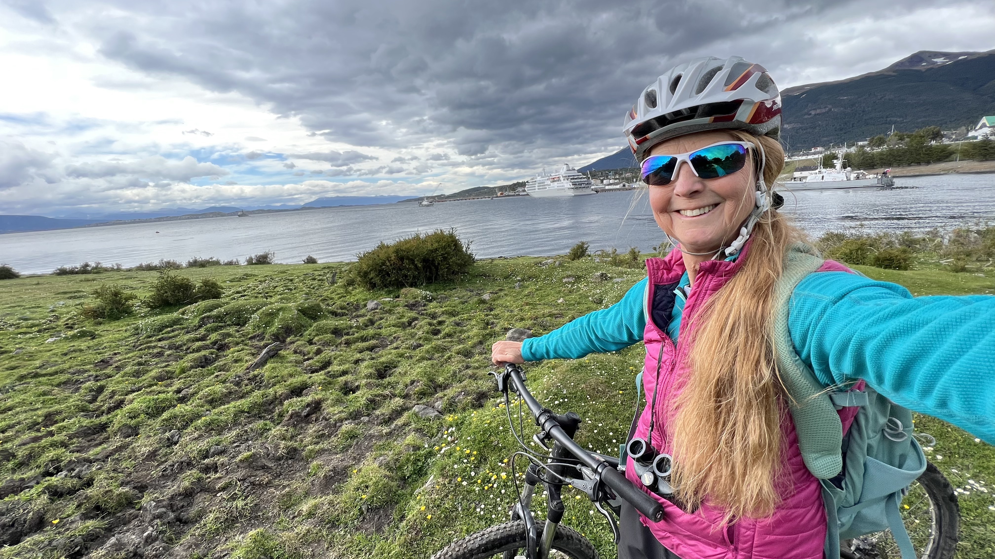
My voyage on Silver Wind ended here in Puerto Williams, and I was pleased that I was able to arrange for at least one overnight here before travelling to my next work contract. I rented a bike, and spent my day peacefully riding around and hiking, reconnecting.
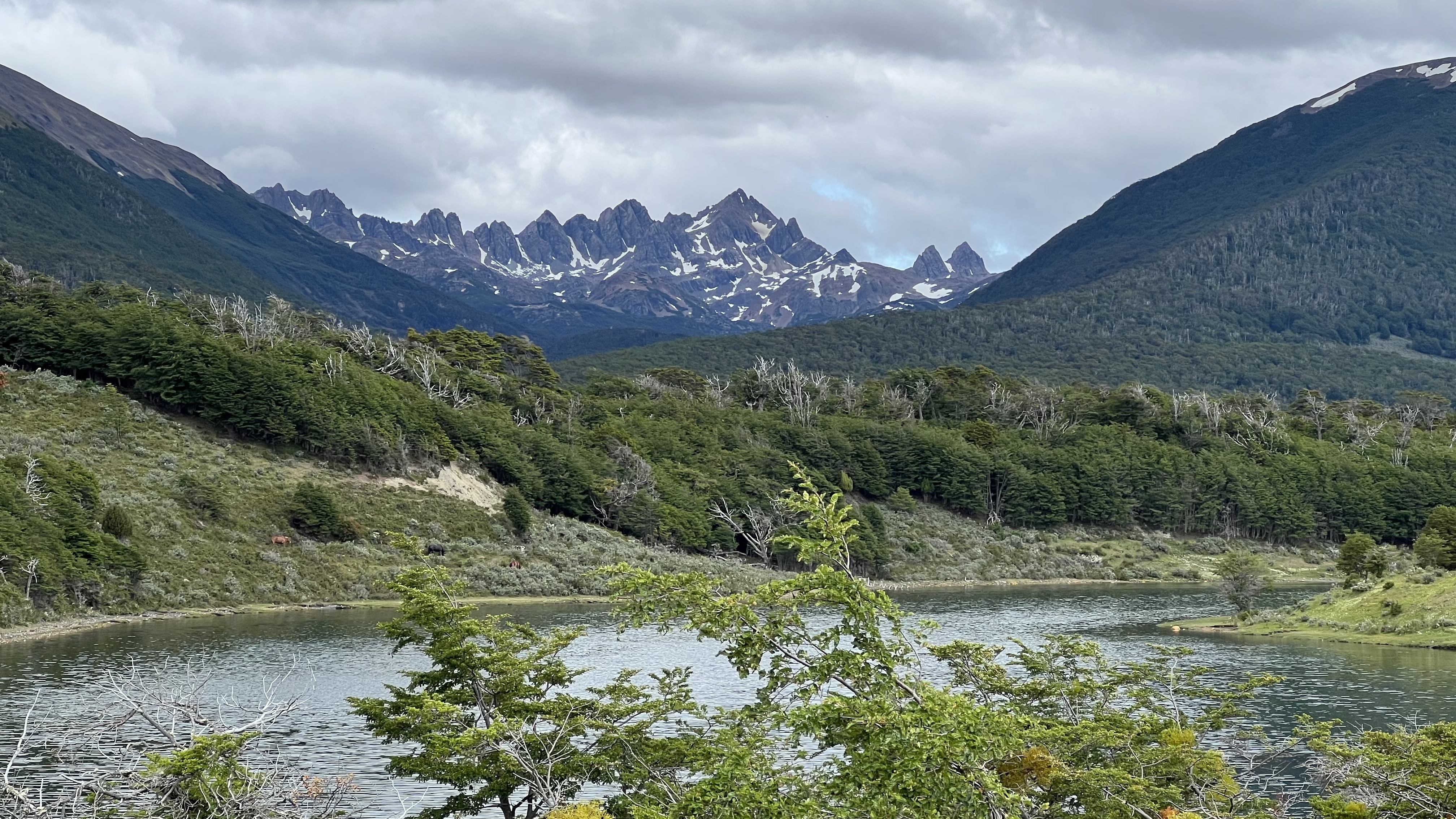
This place means so much to me… my short stay – the first since before COVID – was especially emotional, as we lost our grandmother the abuela Cristina Calderón earlier this year. The abuela was the last pure-blooded Yagán person and also the last remaining native speaker of the Yagán language – a loss so personally heartfelt to all of us who knew her, and a loss to all of humanity as well.
This place is not the same without her. Nor is our world…
Awarded RCGS Sir Christopher Ondaatje Medal for Exploration

This week, I was awarded the Sir Christopher Ondaatje Medal for Exploration by the Royal Canadian Geographical Society.
What an honour! I am quite overwhelmed. Because of COVID, the medal was presented at the online RCGS Fellows Show rather than in person in Ottawa. Here is my acceptance speech:
Although I have lived a life of exploration – sometimes as part of a large expedition team, sometimes leading groups as a wilderness tour guide, and oftentimes on my own solo expeditions – I am overwhelmed by this acknowledgement. It certainly inspires me to live up to it by continuing to embark on adventures and explore, and to share my experiences with the world.
Many thanks to my many friends and supporters – and especially to RCGS Fellows and friends Russell Clark and Jill Heinerth – and to the Royal Canadian Geographical Society for their confidence in me.
The baby salmon are drying up. Again.
Once again, excessive heat combined with a drought make a deadly combination for salmon on Vancouver Island. Back in 2013, Dave and I did a rescue of dozens of baby salmon from a tiny pool that was drying up in the ravine beside out house in Port Alberni, moving them to a larger pool where they would hopefully survive until rain came.
Well, that was back in September. Now, we’re doing the same thing in July. Not sure that these salmon will make it until the autumn rains, but we’re trying anyway.
These photos are from a creek that tumbles (or should tumble) into Sproat Lake. We’ve been going on some hikes there lately, and watching the little pools shrink until they are the size of a frying pan – and then dry up. There’s a very smart snake who clearly understands that these are his frying pans: we see him at the edges of a different pool each day, once they have shrunk to nearly nothing and the fish in them are concentrated there and easy pickings.
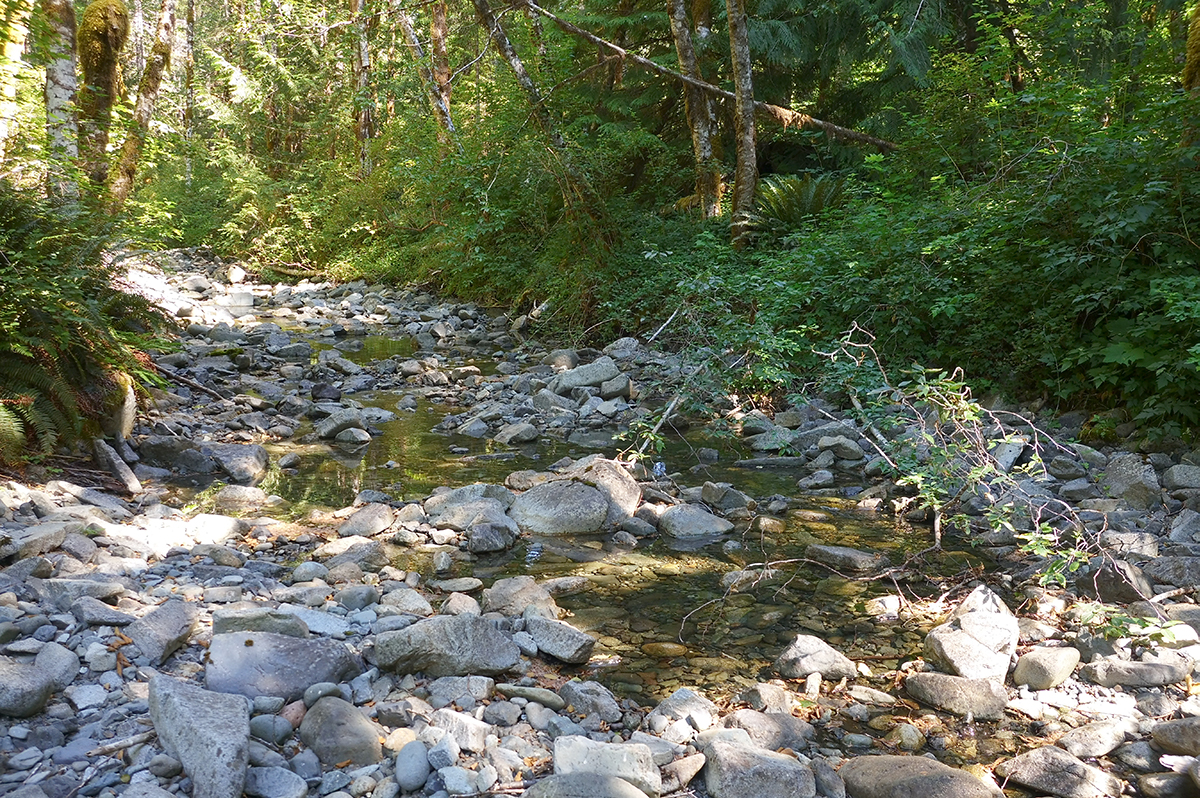
This weather and this drought: not only do they kill the baby salmon by drying them up, they also kill them by destroying the water quality (too warm, or algae blooms) and by exposing them to predators.
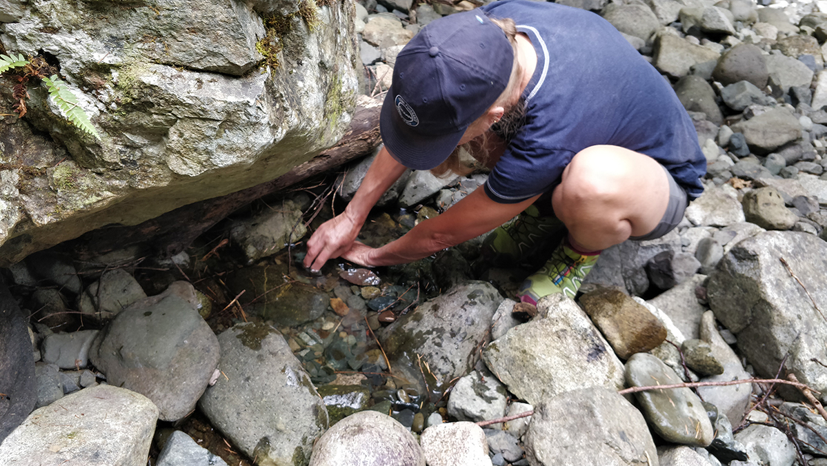
We executed a small rescue the other day – not like the last one where we caught the salmon in bulk in nets. This was just one tiny puddle with one terrified salmon scooting around and that snake lurking at the edge. It felt much more personal.
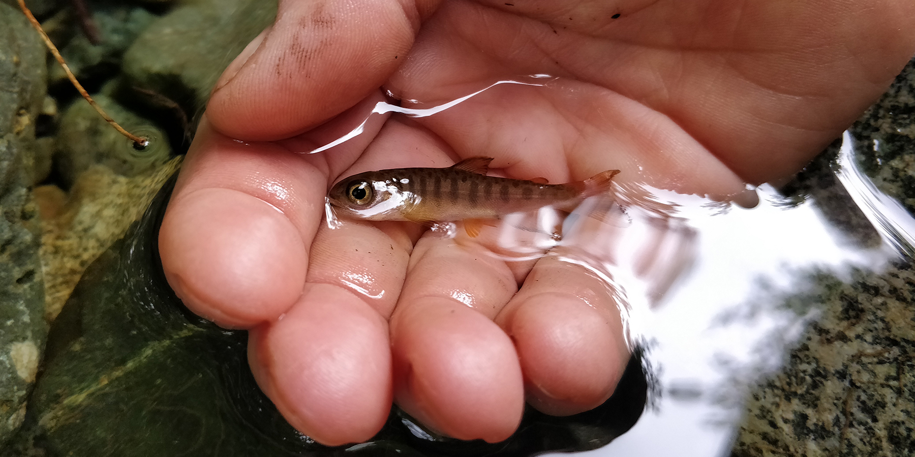
Dave said I would never be able to catch him with my bare hands (the salmon instinctively hide between or under the rocks) – but I knew that my childhood summer experiences at our cottage would serve me well, and I went for it. (Topside photos by Dave, underwater images by me on my new Sealife DC2000).
I did catch that little guy – eventually. But as I did, another one scooted out. There were two in there! When I came back for the second guy, there was still another one in there. In all, I caught five baby salmon in this tiny puddle.
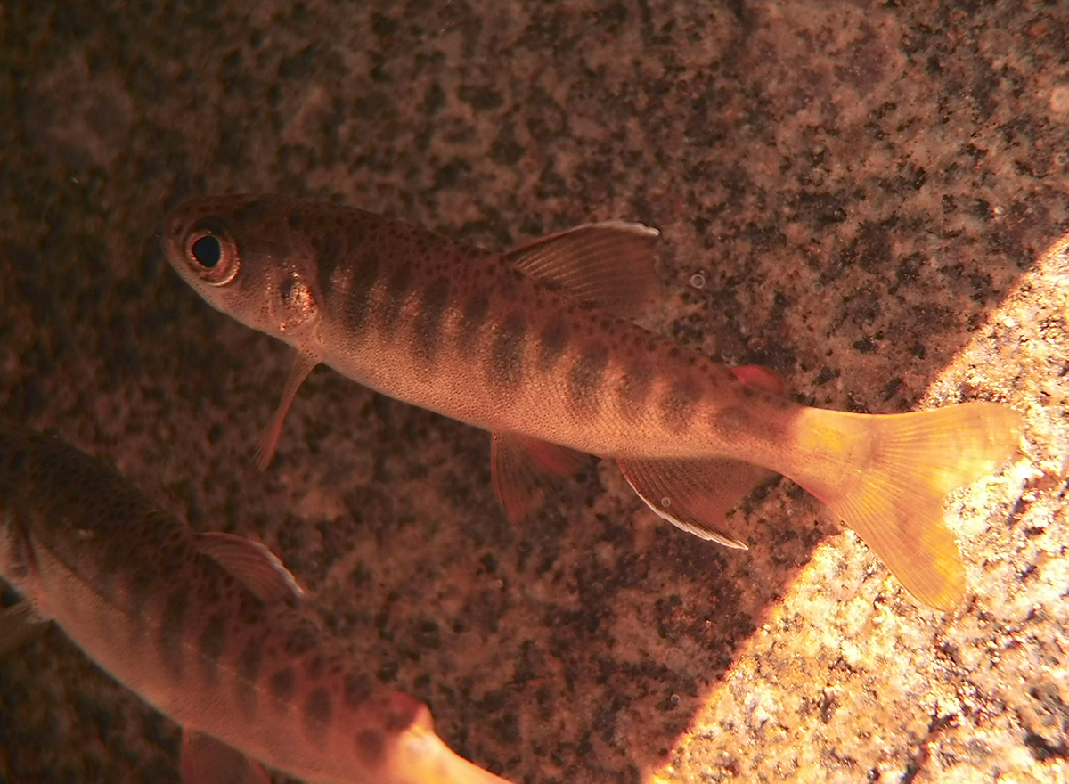
The baby salmons’ instinct is to hide from predators, so they squeeze behind and under the rocks. It was a challenge for me to pull each one out of that pebbly pool without injuring them.
So much for our hike that day. Instead, we spent an hour catching five little guys!

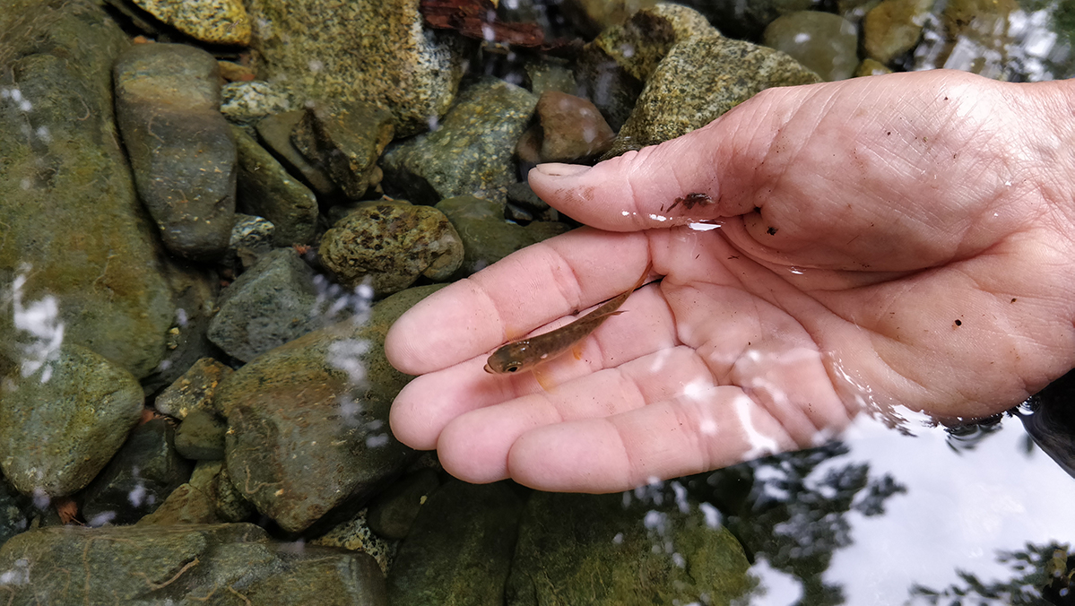
Then I would walk upstream, with a slippery little fish wiggling in my bare hands (super careful not to drop him on the dry rocks!) and release him into a larger, shaded pool.
I’m not at all confident that this pool will make it through this drought either. We desperately need rain. And this is only July.
Here are some of the happier guys in the bigger pool:
If you like what I post or are interested in following my adventures and projects, you can sign up for my (very occasional) mailing list – I’ll never spam you, I promise!

I’m very happy (and proud) to have just finished the 4-month Bridgewatch Enhanced program at British Columbia Institute of Technology, in North Vancouver! This certification qualifies me to work as a deckhand. Over the long-term I am hoping to return to expedition cruise ships both close to home (along the BC coast) as well as far away (back to Antarctica, Chile, the Canadian arctic – wherever!) I’m especially hoping for work that doubles using my new nautical certifications along with my sciences background and/or photojournalism experience.
Over the short term, I’m looking forward to working on the water in whatever I can, to consolidate all the skills I have just learned through practical experience.
The whole Bridgewatch program was four months long, but of course right now, due to COVID, they are doing their best to reduce the time on campus and deliver the parts that they can do online that way.
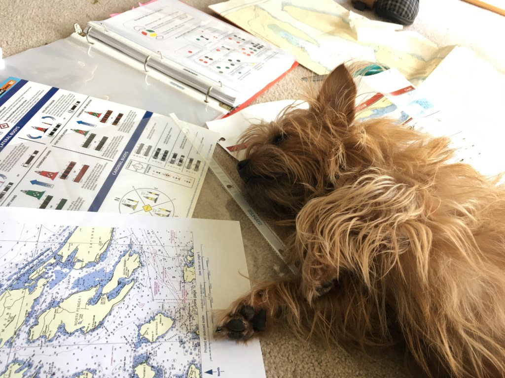
So we did the more “booky” sections, such as Collision Regulations and Navigational Aids online. Here’s a pic of Ferg helping me with my Chartwork.

Much of what we were learning was very hands-on material, so the current COVID situation did make things challenging. We couldn’t interact very closely in class at all, and the field trips and ship ride-alongs that would normally be part of this program were nearly all cancelled.
(I have to say, though, I was very impressed with BCIT’s policies regarding COVID and keeping everyone safe. I was a bit worried about how that would go before I got there – but it was all good!)
So I didn’t get to toss a big mooring line from an actual ship to an actual dock. But here’s a little example of me practicing in class!
Ropework was in fact quite a major component of the class time once we were physically all together in class. This is something I previously knew nothing about, but really love doing (and am getting very good at!)
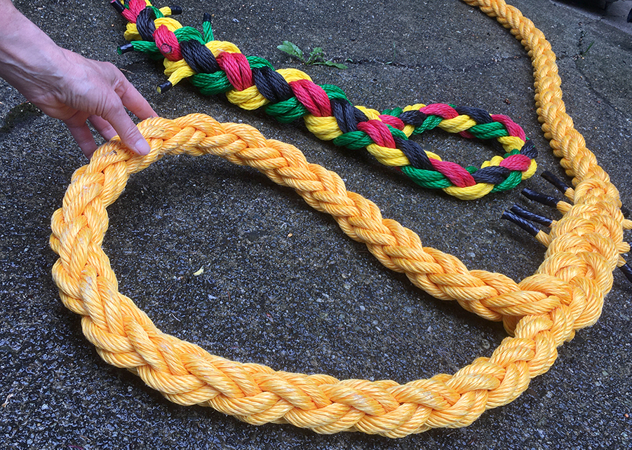
I can now splice all kinds of rope – three-strand, eight-strand, double-braid. I did these big mooring lines, and I also have made Ferg a really cute little custom dog leash!
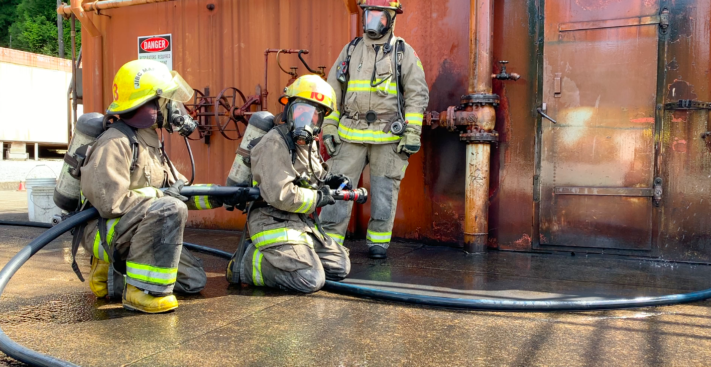
The “regular” Bridgewatch program is more like three months long. The “enhanced” one that I was fortunate enough to take included additional courses: we also did our Radio Operators (Commercial) license and Marine Basic First Aid, as well as the internationally sanctioned safety courses (STCW BST and PSC), that are required to work at sea. They cover basically every aspect of safety on ships at sea: all your life-saving equipment, launching and recovering survival craft (as well as how to actually survive on them if you are stuck in them for days or weeks), and even four days of marine firefighting – which was very intimidating for me at first, but very empowering as I got over my fears. That’s me in the middle, holding the hose, about to enter a burning faux-ship! (The fire in it was not faux).
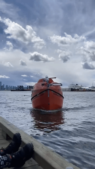
Aside from the firefighting, we learned about and practiced launching and recovering three types of survival craft: lifeboats, life rafts, and rescue boats. We also had pool sessions to learn how to don and swim in immersion suits, and to practice skills such as getting into the life raft from the water.
This is me, docking the lifeboat – first try!
Like I said, because of COVID our class was not able to get out on the water much. So it was a real treat for us to get out on the water during our final week with Group Ocean, one of the tugboat operators on Vancouver Harbour. Their tugs are big and powerful – super impressive – and being out on two of them made it easy for us all to maintain appropriate physical distancing.

Here the Group Ocean captains are demonstrating how they can spin the boats around – first the other one, then, quite to my surprise, the one that I am on while I was filming!
I’m already putting my new skills to use – the photo at the top of this post is just the other day out on Sproat Lake with Dave. We had to tow some logs back to the lakehouse, and I was able to put my new splicing skills to good use making a towing bridle and tying the towline securely. I am super excited, and currently looking into a few work possibilities for this summer. It feels really good, getting more comfortable with what I need to know and do on the bigger ships.
Many thanks to my great BCIT instructors, and also to my amazing classmates (some of whom shot the photos/videos of me here). See you on the water!
And if you like what I have here on my site, or want to keep informed about my current exciting projects and adventures and speaking engagements, please sign up for an occasional email update on my Contact page. (Don’t worry, I respect your privacy and I will never spam you!)
